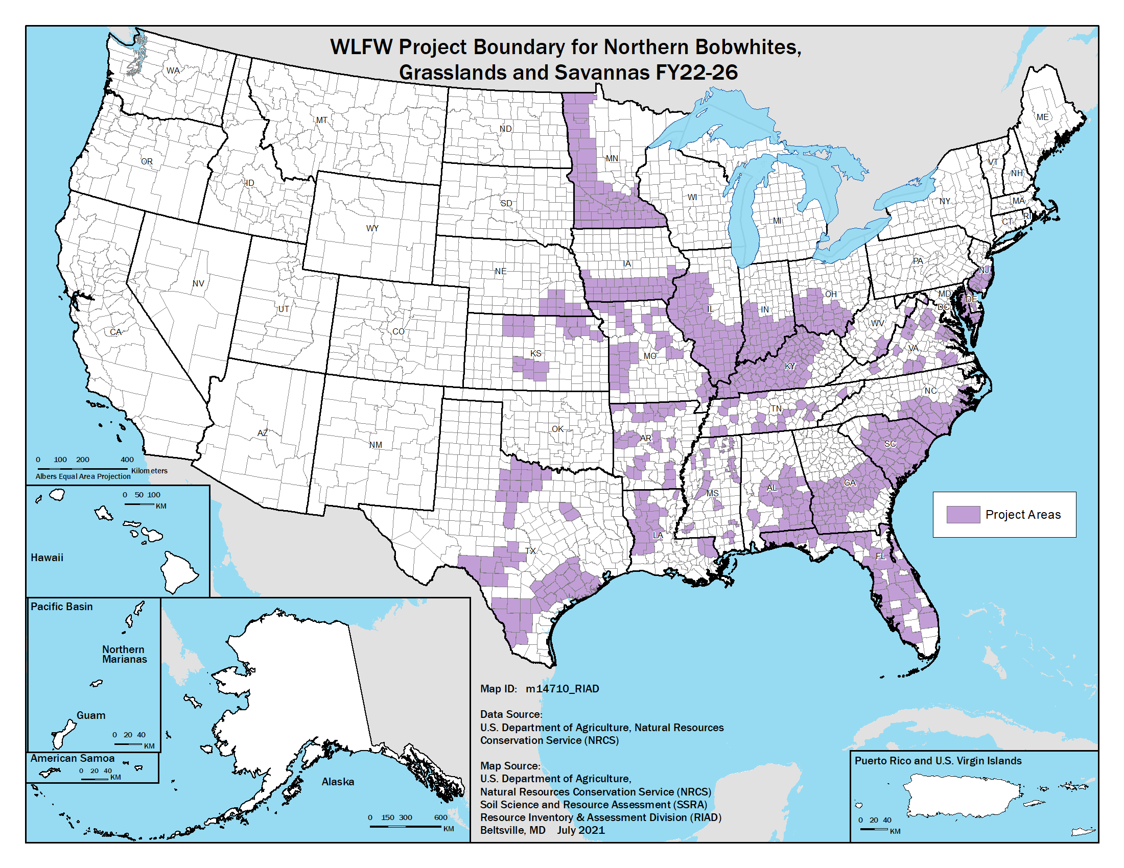
WLFW Northern bobwhite, Grasslands, and Savannas National Map
Framework Boundary (Note some states have smaller priority areas within these boundaries)
Attached pdf of the national boundary for the new framework for conservation action (2022). Shapefiles available under "Boundaries and Priority Areas"
Publication Date: 2022
Credits: NRCS-WLFW
Source: NRCS
DOWNLOAD FILE — PNG image, 293 kB (300,840 bytes)


