Working Lands for Wildlife (WLFW)
The WLFW webportal enables interaction between NRCS's WLFW partners and others interested in conserving whole landscapes and empowering rural economies.
The content here augments those WLFW resources available for on USDA's website, and allows users (including landowners) access to a wide variety of information, online training materials, planning and decision-support tools, as well as access to experts, NRCS field staff, and landowners.
Focus Species
WLFW partners with private landowners to conserve large, intact landscapes for people and wildlife. We do that by focusing our efforts on “umbrella species” that act as bellwethers for how their ecosystem is faring.
Learn more about each species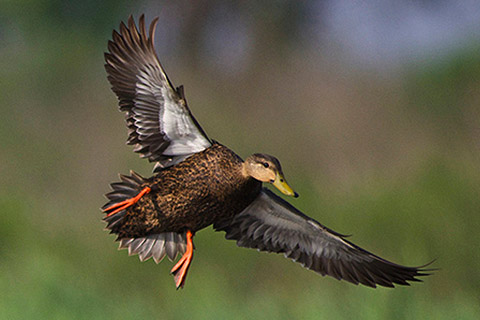
American Black Duck
Read More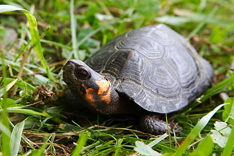
Bog Turtle
Read More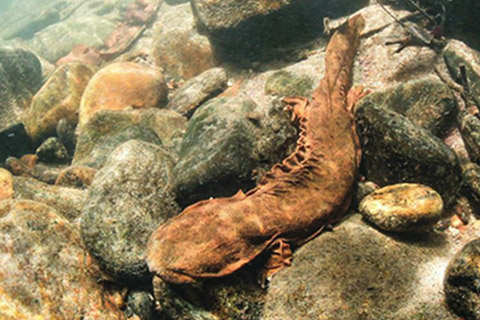
Hellbender
Read More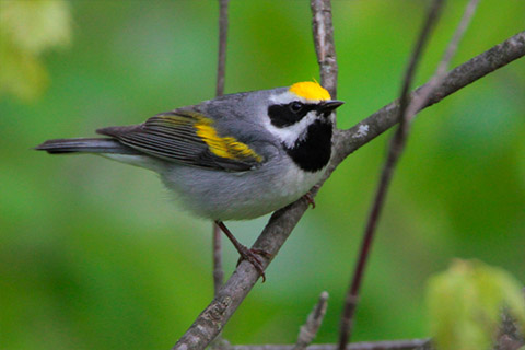
Golden-winged Warbler
Read More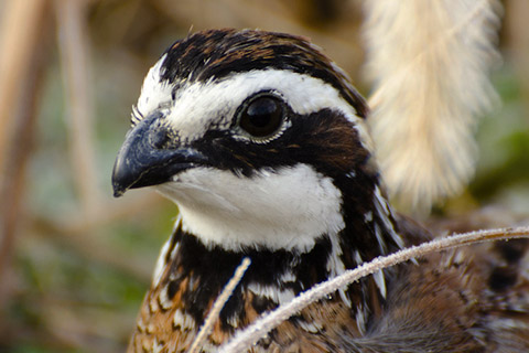
Northern Bobwhite Quail
Read More
WLFW Conservation Tools
NEW MOBILE APP!
A Mobile App to track Northern Bobwhite on Our Landscapes
The app is a citizen science tool that can be used by the public to contribute to our knowledge of the distribution and abundance of Northern Bobwhite
NEW TOOL AVAILABLE!
LITERATURE GATEWAY
A Systematic Map of Bird-vegetation Relationships in Eastern and Boreal Forests
This tool allows users to search for literature on bird species-vegetation relationships in eastern and boreal forests of North America.
NEW TOOL AVAILABLE!
BirdLocale: WLFW Landscape Restoration Bird Assessment
This tool helps biologists gather field data, including bobwhite counts and percentage cover of various types (grass, shrub, forb), using both manual and Acoustic Recording Unit (ARU) methods to capture bird calls.
FIRE MAPPING TOOL!
The SE Firemap maps all detectable fires, including managed prescribed burns and wildfires, across nine states in the southeastern United States.
Stay Connected to Working Lands for Wildlife
WLFW News Gallery
News articles and events on WLFW and Target Species sites.
-
Mar 14, 2025
NRCS Working Lands for Wildlife Presents: Breakfast With Biologists-March 27th 2025
Woodstown, NJ – Quail Forever, in partnership with Ducks Unlimited and the New Jersey Audubon Society, will cohost an informational outreach event for landowners on Friday, March 27th, from 7:00 am to 9 am at the… More -
Jan 21, 2025
Join the Bobwhite in Hardwood Forested Systems Webinar!
Join us February 13th at 11:30 AM CST for a webinar on Bobwhite in Hardwood Forested Systems. We will be joined by John Gruchy of the Mississippi Department of Wildlife, Fisheries and Parks.… More -
Jan 13, 2025
SE CASC Science Seminar, January 22: New Project Lightning Talks
Join us for a series of 5-minute talks summarizing newly funded SE CASC… More
WLFW Resources
In the Working Lands library, you will find project reports, presentations, peer-reviewed studies, and more.
-
Monarchs in the Southeast
A guide on the life history, common threats, and conservation measures you can implement to support… More -
Aquatic Connectivity Framework (ACF) Fact Sheet
The Aquatic Connectivity Framework (ACF) is a WLFW partnership effort that brings together public and private partners to tackle critical… More
Videos and Webinars
You can customize your learning with a collection of webinars and videos about landscape conservation and working lands. View the videos you want on your own schedule.
-
WLFW East Region Conservation Webinar Series: Northern Bobwhite Session #7 “Quail Monitoring Methods”
Session 7 of the “Northern Bobwhite” mini-series was presented by Diana McGrath with Georgia DNR. This session focuses on different… More -
WLFW East Region Conservation Webinar Series: Northern Bobwhite Session #6 “Bobwhite in Hardwood Forest Systems”
Session 6 of the “Northern Bobwhite” mini-series was presented by John Gruchy with MDWFP. This session focuses on the Northern Bobwhite… More
See the NRCS WLFW website for specific information on: WLFW national and state-run target species partnerships; priority geographies for implementation; strategic plans published by USDA; how to participate in Farm Bill programs; and news and blogs about WLFW activities.